Utah’s Gloria Falls Trail is glorious with loved ones
Hiking Gloria Falls Trail in Utah is a fantastic way to spend a morning. The trailhead is just a 40-minute drive from downtown Salt Lake City, and the 50-foot falls are a refreshing place to relax on a warm day.
I was in town to visit relatives, and my daughter offered to go with me on the 2.2-mile, out-and-back hike.
(Jump to trail stats here.)

After years of trekking, I’ve concluded that what makes a hike great is not always where you go. Often, it’s with whom you go.
Most of my treks are with the Unshakable Husband, aka Mr. Unshakable, or just Jon. He’s the default, my rock in all things outdoors. He may even like hiking more than I do. (He just doesn’t blog about it.)
Still, it’s a treat if one of my kids or kids-in-law decides to join me.

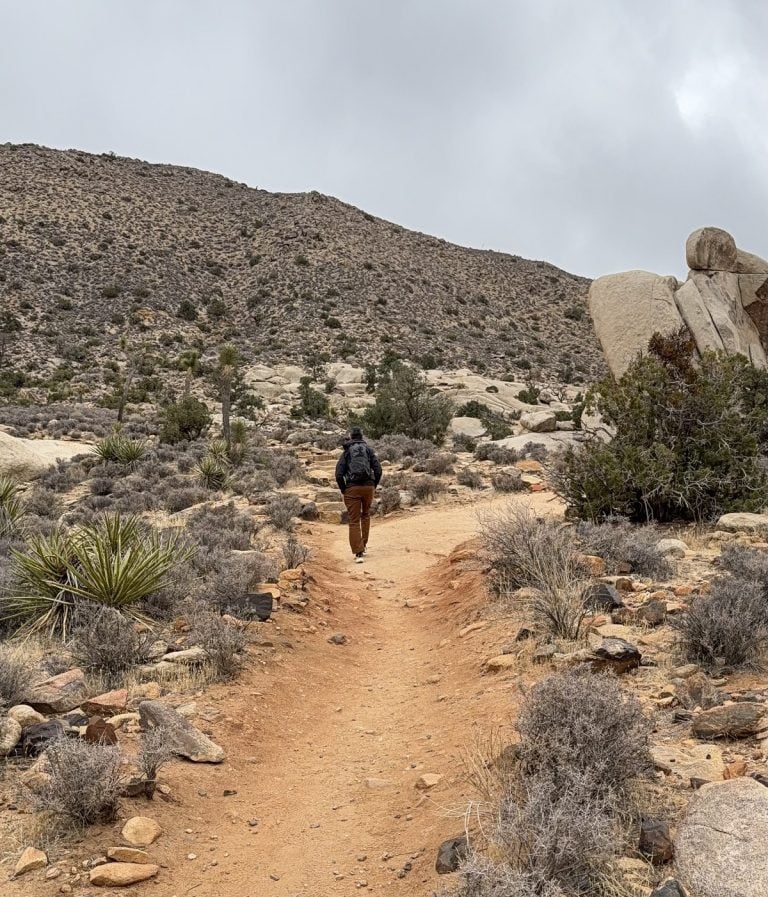
So Anna and I headed up Little Cottonwood Canyon on a sunny August day. This was the view looking behind us.
We arrived by 8:30 a.m. and the parking lot had just filled, so we parked close along the canyon road.

At the trailhead I made sure I had downloaded the map on my hiking app. The route had lots of off-shoots, and I didn’t want to stray from it.


Early on, we crossed a bridge, and the trail was smooth. Then it became rocky and rooty for much of the time.
Parkinson’s tip
You may be able to get by on this trail without trekking poles, depending on your steadiness and ability to walk on an uneven surface. The route doesn’t have any exposed areas, if falling off the path is your fear. When in doubt, bring the poles!

Most of the trail was shaded. Aspens framed the path. In a couple more months they would look stunning in their autumn yellowness.
We had a lot of time to chat, but most of the time we were quietly enjoying the sights and sounds of the mountain woods.
Almost from the start, we were climbing upward. The elevation gain of the trail was about 520 feet, and it did not feel excessively steep. But the uphill was relentless – there were hardly any places the trail flattened out, allowing us a breather.
This sign was somewhat helpful, though our goal was not the lakes mentioned. We headed toward Red Pine Lake, determining that we would be on that path only a short while.


Because of the many trails in the area, it was easy to get confused where to turn. At one point we saw on our map that we were going in the wrong direction, so we had to do a “180” and walk back to the junction.
But seeing a really dense aspen forest due to our waywardness made it OK.
So our next steps were back to the point of our wrong turn. When we got there, we chose the other way.
Since the turnoff for the falls is not well marked, and because I try to be a helpful blogger, I took a picture of where to turn to get to the falls:

After crossing the small plank, go left immediately and start hiking along the RIGHT SIDE of the creek going up.
The trail wasn’t clearly defined from that point to the falls, but we kept the creek on our left.


Gloria Falls came into view after just a few minutes.

It was a lovely sight. There was time to have a snack, take pictures and enjoy the mist. We opted not to remove our hiking shoes for a foot dip, but that could be refreshing, too.
Soon we headed back down. A lot more people were coming up now.
Parkinson’s tip

I tend to hike at a slower pace than most people. If that’s your modus operandi too, you may find it awkward, even unnerving, when speedier hikers want to pass you.
The best way to avoid this is to go at times when most others don’t. Arrive as early as you possibly can. (Not a problem in my case. Because of my Parkinson’s, I am unable to sleep in anymore.)
The drive back gave us beautiful vistas of the Salt Lake Valley. This mom had a really great morning, and I’m pretty sure my daughter did, too.

Hike info
PD difficulty level (see chart): moderate
Distance: 2.2 miles roundtrip
Elevation gain: 532 feet
Trailhead location: In Salt Lake City, at the mouth of Little Cottonwood Canyon, Wasatch Boulevard becomes the canyon road. Drive up from there for a little over 5 miles. The turnoff is on the right, and you you may see a sign for “White Pine Lake.”
Bathrooms: at trailhead
Emergency medical support: within 20 minutes from trailhead
Cost: none
Road access to trailhead: on busy days you may have to park a ways down the road.

Insider tip: A hiking app that tracks your progress will alert you when you’ve left the route. That was super helpful for us on this trail.
(Back to top)
Learn about another Utah hike that could work well for families and people with Parkinson’s here: An easy mountain hike near the Utah-Idaho border


I love to hike also! Thank you for the great suggestions! I always bring poles because you never know when you will need them. I noticed I have more trouble walking up steep trails. Has this happened to you? I too have gotten slower but hope to never stop hiking!
Thanks, Shelle. I plan to hike until I can’t stand upright, and even then some! As for steep trails, I’m usually OK with them, but I am much more concerned about balance and missteps than I used to be. I predict I’ll be engaging the trekking poles more often in the near future. You’re right, you never know. Thanks for reading!
This was such a beautiful hike! So glad I got to do it with you.
I don’t recall you ever being a slow hiker; that designation was reserved for me.
Maybe so, Dave, but I’m fast “catching up” with you. 🙂
We loved seeing you and your sweet family. Hiking does tend to re-center one after losing a dear family member. Thanks for sharing.
Thoughts of loved ones, both past and present, come easier when you’re among God’s creations. You know that well, Bryan!