Reaching the 3rd-highest peak in the Smoky Mountains
At 6,593 feet high, Mount LaConte is a big draw for hikers in Great Smoky Mountains National Park. Since I love reaching high places, I decided to give this Tennessee trail a whirl.
(Click here for hike stats.)
For hikers like me who have Parkinson’s disease, I’ve rated the trek as very difficult. Hard hikes seem to be getting harder for me–certainly not unexpected. But I was able to finish this 11-miler on a cloudy, partly rainy day a few months ago.

The trail features lush foliage, an arch, a cave, and cabins at the top where you can stay overnight (make your reservation a year out). You can expect 3,000+ feet of elevation gain on this hike.
Parkinson’s hiking tip

To reach the peak, you’ll need to be in good shape and able to keep your balance when exposed to drop-offs not far from the trail’s edge. If going to the top sounds like too much, a hike to the cave and back is a nice alternative at 4.5 miles roundtrip.
There still will be some fancy footwork required and stairs to climb, but much less exposure. Bring trekking poles.
Great Smoky Mountains is the most-visited national park in America, both for its beauty and location. The vibe of these mountains is very different than that of the Rockies, which can appear harsh, even fantastically forbidding. The park has 850 hiking trails of all levels, including a wheelchair accessible path near the Sugarlands visitor center.
The Unshakable Husband and I visited in late April, meaning we’d see fewer hikers on the trail, which is called Alum Cave to LeConte Peak. But alas, the small parking lot was full when we arrived at 1 p.m.
The park allows shoulder parking along roads, as long as all four wheels are on pavement. (More parking info below.) We found a place next to the road not far from the trailhead.


With our late start, we didn’t waste any time hittin the trail.
The first mile was lush with spring greenery, and it followed a creek on the right for a short while.


The bridge crossings – six of them – were a delight, as most bridges are on hikes.

One interesting feature was Arch Rock. Walking through it felt like I was in a cave for a few moments, but then I climbed up and out the other side.
Stairs and more stairs came next.

After an hour of uphill trekking – about 1,100 feet elevation gain – we reached Alum Cave. The “cave” was more like an indented wall, but it was a nice resting spot.
Parkinson’s hiking tip
This is a good place to decide whether to continue to the top. Even if you do reach the peak, will you have enough energy for the hike down? Be honest with yourself and know your capabilities.
We carried on. Rain clouds were marching toward us.

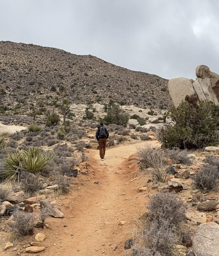
More going up, up, up. The views were getting more intriguing and beautiful, but trees blocked some of them. And when the mist rolled in, I was were reminded of the reason these mountains are called Smoky.

As we got higher, the trail was alternating between rock and dirt. The rock was slippery when wet, so I got out a trekking pole for assistance. The cables attached to the side rocks were a relief to hang onto.
Hope of seeing anything from the peak were fading as fast as the fog was thickening.
Parkinson’s hiking tip
If you’re a gal, be aware there will be no place to pee in privacy off the trail from the Alum Cave almost until you reach the outhouses at the top.
The path leveled out near the top, and we sauntered along a wide trail through a lovely, mossy forest. Finally, the cabins came into view through the fog. We found the outhouse (no line!), and looked around at the quaint mountain peak “village.”


The wind was strong and I realized we were both underdressed for the weather at the top. You’d think I’d have learned by now!

See our fantastic view? I tried to imagine what I would be seeing on a clear day. Didn’t help much.
Nevertheless, we made it to the top!
I’m told the rhododendrons at the peak look stunning when they bloom in the summer.
Some people had stayed the night in the cabins but were gone by now. The small store and dining room were closed when we got there; glumly, we realized there would be no place to warm up, and I consoled myself by downing another Kind bar.

One of the workers told us we could take a short out-and-back trail to another lookout. Even with zero hope of seeing a view, we took her suggestion and climbed the .2-mile Cliff Tops path. It was dense and mostly protected from wind and rain, a nice reprieve.
It was time to head back. Light rain was off and on now, but I was feeling warm again.

I really liked this horseshoe bend, which I hadn’t noticed on the way up.
By late afternoon we were back at the Alum Cave, where we took another rest.
Back through the arch we went, then it was a long jaunt to the trailhead.
Parkinson’s hiking tip
This is for anyone, really. The last couple miles of any hike can be dastardly long. I listen to tunes and sometimes sing along. Be sure to bring headphones that are NOT the noise-canceling type, so you can hear when other hikers are around you.
The beauty of the Alum Cave trail to LeConte Peak trail was worth the effort. I’d like to go back for sunny-day views in the future. Whether I do depends mostly, of course, on my Parkinson’s.
Hike info
PD difficulty level (see chart): very difficult
Distance: 11 miles roundtrip
Elevation gain: 3,050 feet
Trailhead location: Along Hwy 441, 9 miles south from Sugarlands visitor center
Bathrooms: pit toilets at trailhead and at the peak
Emergency medical support: clinic in Gatlinburg, within 30 minutes from trailhead
Costs: Parking tag required: daily fee is $5. There are no entry fees at this park.

Insider tip: With the new parking tag program, you’ll be able to park only in designated areas. Lots fill fast, as early as 6 a.m. in summer. If you miss getting a place, you may be out of luck. So have a plan B hike ready, just in case.
Learn about another Great Smoky Mountains hike I did, the Laurel Falls trail, rated easy.
(Return to top.)


Hello Colleen,
Oh yeah, , the Smoky Mountains! I have done many miles down there and Mt. LeConte was definitely one of the better trips. My buddy and I were fortunate enough one year to be able to have a night in a cabin on top. Believe me it was a good dinner and a fantastic breakfast for the hike down. If you ever get the chance, do not pass up staying up there. Of course, all of this was pre-Parkinson’s days but there are many trails that could be passable for someone with PD.
Merry Christmas,
Tom Holmes
Bourbonnais, Illinois.
I agree, Tom, the Smokies have something for everyone and every ability. Thanks for your ideas!